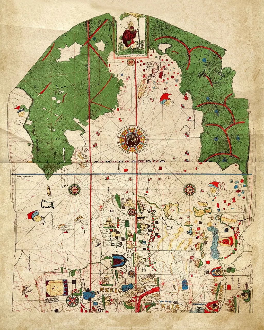
The earliest known map of the New World was drawn in 1500 by Juan de la Cosa. It is known as the Juan de la Cosa Map or the Universal Chart of Juan de la Cosa after its creator. De la Cosa was a contemporary of Christopher Columbus and fellow mariner, navigator, and skilled cartographer. He was also the owner of the Santa Maria, one of the three ships that sailed with Columbus in 1492. In total De la Cosa participated in seven expeditions to the Americas, exploring the Caribbean extensively in search of a new route to China. He is credited with creating some of the earliest known maps that depicted the lands of the Americas.
This particular map is significant for its early depiction of the Caribbean and the lands explored by Columbus, including parts of South America and Central America. It's a crucial historical artifact that provides insights into the European understanding of the New World at that time. The map is made up of two separate parts, the New World and the Old World. Some of the outlines on the map pertaining to Europe and Africa were copied from previously available maps.
Although the outlines of Europe and Africa's western continents have grown faint, numerous significant landmarks are still clearly illustrated on both. Moving eastward, de la Cosa roughly outlined his vision of the North and South American coastlines, accompanied by a more intricate portrayal of the recognizable Caribbean islands, which had become familiar to him through his journeys with Columbus and other explorers. The map is positioned with its northern orientation at the top and showcases multiple compass roses and rhumb lines.
The depiction of the Americas reveals a lush, green landmass stretching deep into the North Atlantic. They are represented in a manner that could potentially signify extensions of Asia rather than entire separate continents.
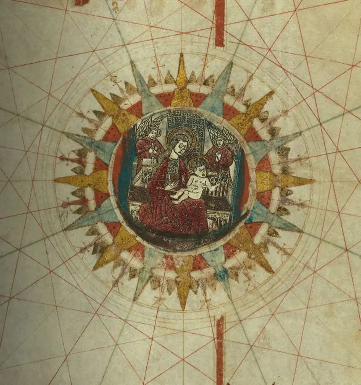
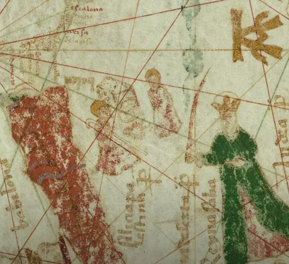
Illustrations covering Europe, Africa, and Asia reference not just geographical aspects but also encompass political, economic, and religious elements. The birth of Jesus is depicted in Bethlehem with the Queen of Sheba in the nearby Arabian Peninsula. The compass rose, portraying Mary and baby Jesus, was illustrated on a separate sheet of paper, then carefully cut and affixed to the map.
 Image. The Compass Rose, map part
 Image. Bethelem, map part
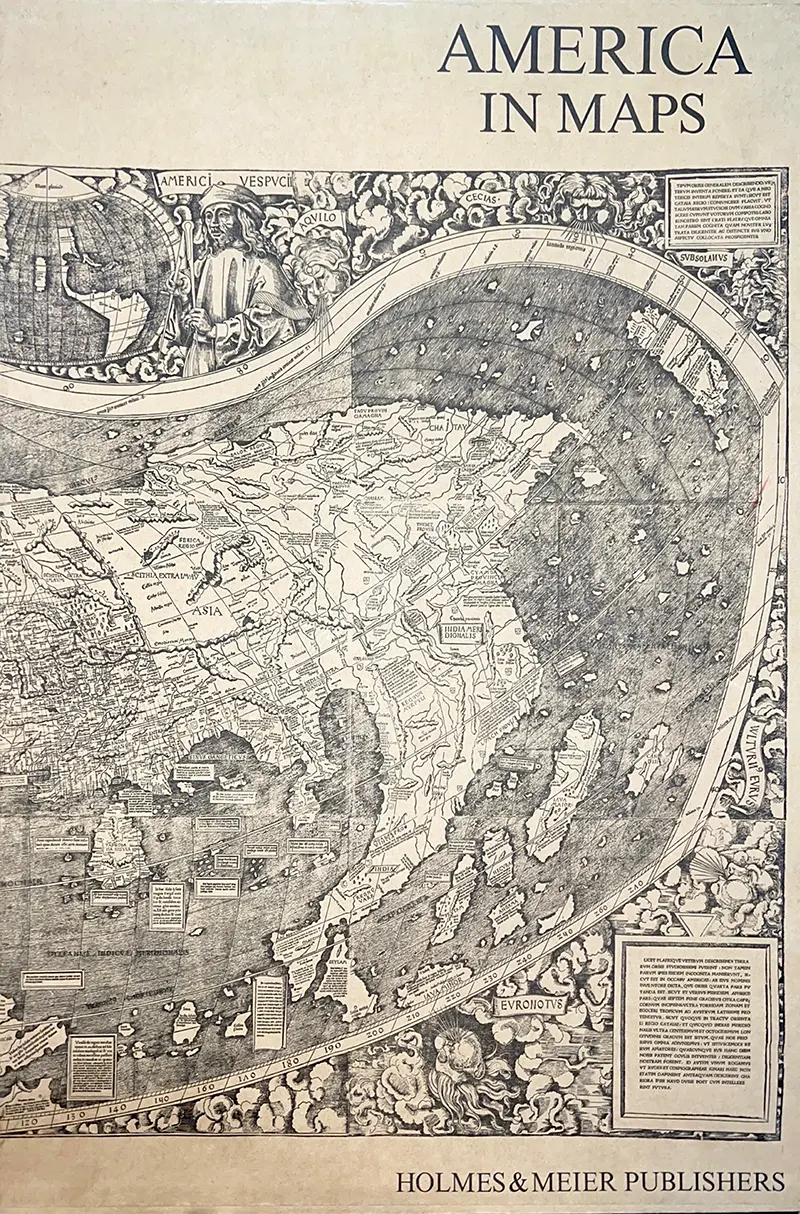
 Book: America In Maps Dating from 1500 to 1856
The Juan de la Cosa Map is found in the library’s Special Collection department in the oversized book America in Maps Dating from 1500 to 1856. The Original map was purchased by the Spanish government in 1853 and is now part of the collection of the Naval Museum in Madrid.
It is important to note, the legacy of Christopher Columbus and those associated with him on his voyages to the New World is a complex topic that evokes ongoing debate and discussion regarding its impact on the course of world history. The voyage in 1492 marked a pivotal moment in the Age of Exploration, as it initiated a series of events that would have far-reaching consequences for both the Old and New Worlds. The Juan de la Cosa Map remains a pivotal artifact of history.
Resources
- Atlas Obscura. (n.d.). Juan de la Cosa Map. Atlas Obscura. https://www.atlasobscura.com/places/juan-de-la-cosa-map Garcia, A. (2019). The Curiously Changing Continent. Dig into History, 21(6), 32–35.
- Factum Foundation. (n.d.). Chart of Juan de la Cosa. Factum Arte. http://www.highres.factum-arte.org/Chart_Juan_de_la_Cosa/shared/viewer.html?showVolver=1
- Klemp, E. (Ed.). (1976). America in Maps Dating from 1500 to 1856 (M. Stone & J. C. Stone, Trans.). Holmes & Meier Publishers.
- Museo Naval de Madrid, Google Arts & Culture. (n.d.). Chart of Juan de la Cosa: The first known map of America. Google Arts & Culture. https://artsandculture.google.com/story/chart-of-juan-de-la-cosa-the-first-known-map-of-america/IgJCiowwoJqZIQ
- New World Encyclopedia. (n.d.). Juan de la Cosa. New World Encyclopedia. https://www.newworldencyclopedia.org/entry/Juan_de_la_Cosa
- Stevenson, E.L., Typical Early Maps of the New World Bulletin of the American Geographical Society, Vol. 39, No. 4 (1907), pp. 202-224 https://doi.org/10.2307/198710


